.jpg)
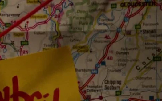
Mary Cooper's map, featuring part of the A40. (TV: The Categories of Life)
The A40 was a major road which from at least the west of England to South Wales.
Part of the A40 crossed the Welsh border just west of Dean Forest Park. When taken south-west, it ran through Monmouth, where it intersected with the A466 and crossed a branch of the River Wye. The A40 curved west, with the A449 branching south just north-east of Raglan. Continuing on the A40, it curved north-west to reach Abergavenny where it intersected with the A465. The A40 then continued north-west into a national park, following the River Usk as it passed through Crickhowell.
Part of the A40 followed the Afon Tywi westwards, then curved south into Carmarthen, where the A48 branched east. The A40 continued west, before curving south-west and crossing a railway. It then branched off into two directions.
The A40 appeared on Mary Cooper's map of overflow camps in and around Wales. (TV: The Categories of Life)
Behind the scenes[]
Although unnamed in The Categories of Life, in the real world the national park seen on the map, which is passed through by the A40, is the Brecon Beacons.
.jpg)